Geomatics (GM)
Email: jose.navarro@cttc.catPhone: +34 93 645 29 00
BSc and MSc (Licentiate) in Computer Science, Polytechnic University of Catalonia (UPC).
PhD in Computer Science, University of the Balearic Islands (UIB)
Member of the senior corps of cartographers of the autonomous government of Catalonia.
Member of the CTTC’s (Centre Tecnològic de Tecnologies de les Comunicacions) department Geodesy and Navigation (Geomatics Division).
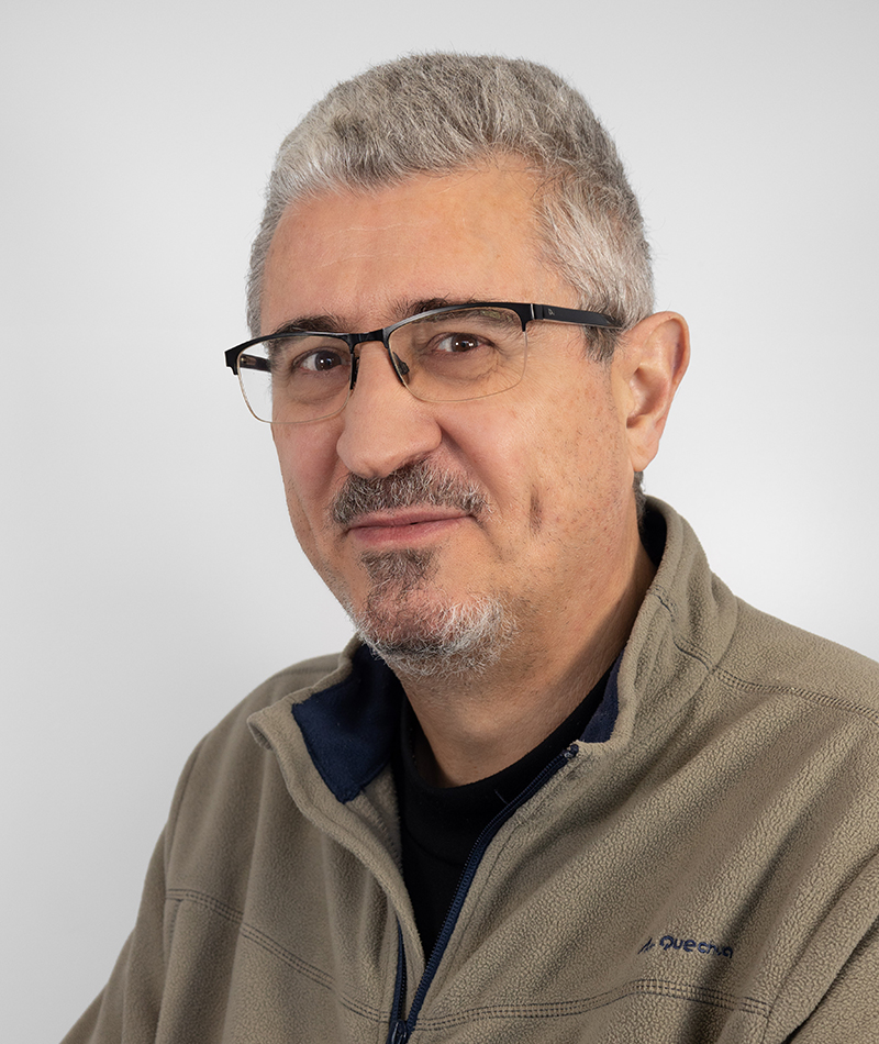
José Navarro was born in Barcelona (Catalonia, Spain) in 1963. He holds a degree in Computer Science by the Technical University of Catalonia (1986) and a PhD in Computer Science by the University of the Balearic Islands (1999). He is a member of the senior corps of cartographers of the autonomous government of Catalonia. He is an expert on software engineering and mass production systems.
Since 1982 until 2000 he occupied several positions in the Institut Cartogràfic de Catalunya (now Institut Cartogràfic i Geològic de Catalunya, ICGC), always as a member of the Geodesy unit. In this period he was involved in the design and implementation of several software systems targeted at the generation of digital terrain models, ortophotos or general bundle adjustment. He was the leader of the project Visual Factory Suite, a complete software suite for the mass production of ortophotos, featuring the possibility to design visually production workflows. This project was the starting point for his PhD work.
From January 2001 to December 2013 he worked at the now extinct Institut de Geomàtica as deputy director for information technologies. He actively participated in several research projects covering areas like general bundle adjustment, GPS differential corrections in web environments, mobile GNSS applications, sensor calibration, radiometric (image) correction, digital image processing, assessment of the navigation algorithms for satellites using unmanned aerial vehicles (UAVs), GNSS / INS / EGNOS algorithms for UAVs, thermal cameras for search & rescue operations, simultaneous calibration of photogrammetric blocks plus LiDAR data, geometric terrain modelling, kinematic systems for the control of railway infrastructures, generation of basic information for the management of urban environments or management of natural resources.
Since the Institut de Geomàtica was merged with the Centre Tecnològic de Telecomunicacions de Catalunya (CTTC) in January 2014, he has been working as a researcher in the Geodesy and Navigation Department (GEON) of the Geomatics Division. Since then he has been working on the inception, design and implementation of an integrated system targeted at facilitating the research in the field of kinematic geodesy, positioning and navigation (GEMMA). Such task involved the design (together with other members of the GEON department and a private company) and implementation of an abstraction to model observation data in the realm of GEMMA. He is responsible of the version of GEMMA that has been deployed as a CTTC’s testbed. He has also worked in the integration of a real-time navigation system for unmanned aerial vehicles (UAVs) relying on the hybridization of GNSS and INS sensors and multiple GNSS antennas to determine the heading without having to resort to magnetometer sensors.
Concerning his main research line, the design and implementation of data models and algorithms for the efficient process of big volumes of data in Geomatics, he has been involved in the definition and implementation of data models for the applications making the GEMMA testbed (the ASTROLABE data model and library), in the efficient implementation of the methodologies targeted at the identification of active ground deformation areas, specially for the monitoring of railway infrastructures, although such methodologies may be applied to any kind of ground movements; he has also devised and implemented visualization tools for the analysis of ground deformation phenomena involving high data volumes as well as algorithms supporting parallel processing for the integration of sensor data in real time. He participated in the preparation of CTTC’s strategic plan.
He has been involved in several European projects, funded by grants from the European Comission (such as the Seventh Framework or H2020 programmes): SAVEMEDCOAST2, HEIMDALL, IOPES, UGeohaz, MOMIT, GINSEC, PERIGEO, ENCORE, CLOSE-SEARCH, COLiDar, GeoLandModels, GeoTRAM, GEODM, AUTORADCOR and UGEI. He participated also in the transference of the technology involving the software suite devoted to Persistent Scatterers Interferometry, created by the Remote Sensing department of the Geomatics Division. Since 2015 he has participated in the preparation of 13 proposals, being the promoter of five of them. He has participated in the organization of several international workshops, the most recent being the 2010, 2012 & 2016 editions of the ISPRS EuroCow as well as the IOPES users’ meeting in 2020.
His activity has always been clearly oriented to the execution of the projects in which he has been involved; consequently, his dissemination tasks have produced just 26 publications, two of these in international journals and the rest in international conferences. Finally, he directed a degree thesis back in 2017.
Scholar Google: https://scholar.google.es/citations?user=yv1N0XcAAAAJ&hl=es
ResearchGate: https://www.researchgate.net/profile/Jose_Navarro41
ORCID ID: https://orcid.org/0000-0001-7877-1516
MISCELLANEOUS
| Scientific papers | 26: 3 journal, 23 international conferences | |
| IPR / Technology transfer | Transfer of the software in the | |
| Persistent Scatterer Interferometry | ||
| in the Geo-Kinesia Spin-Off | ||
| Project participation at | 6 EU projects | |
| CTTC (since 2015) | ||
| Degree theses | 1 supervised | |
| Books (co-editor) | Integrated Sensor Orientation: Theory, | |
| Algorithms & Systems (co-editor with | ||
| I. Colomina). 1995, Wichmann Verlag. | ||
| Contribution to | 20+ | |
| conferences | ||
| Courses and workshop | Three editions of EuroCow | |
| organization | (2010 – 2012 – 2014) | |
| First IOPES users’ meeting |
