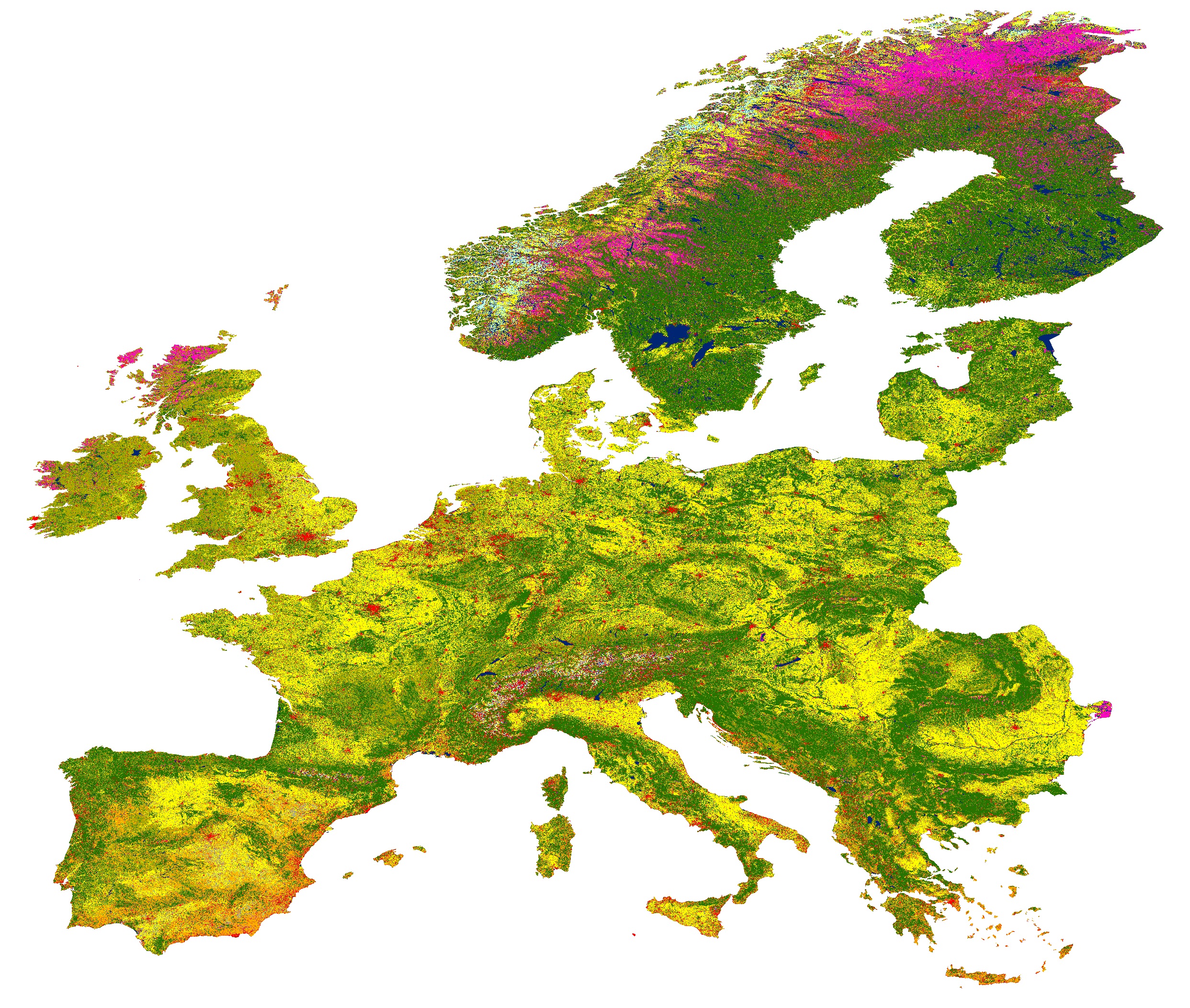
The Geomatics Research Unit of CTTC has generated the most recent map Land Use and Land Cover of Europe(LULC) using freely available big geo-data within a cloud-based platform. LULC maps provide valuable information for defining the terrestrial and atmosphere interactions of the Earth and providing a realistic picture of human activities and natural environment interconnections. This is useful to maintain and improve sustainable development and planning strategies.
We have generated a European LULC (ELULC) map using satellite observations (Sentinel-1/2 and Landsat-8) and in-situ samples (LUCAS). More than 200K and 300K of in-situ surveys and images were respectively employed in the Google Earth Engine (GEE) cloud computing platform for performing the classification by machine learning algorithms. ELULC-10 project presents detailed information on nine representative ELULC classes over seven European ecozones. The technical reports and high-resolution products will be available via Earth Engine Data Catalog and the CTTC website.